
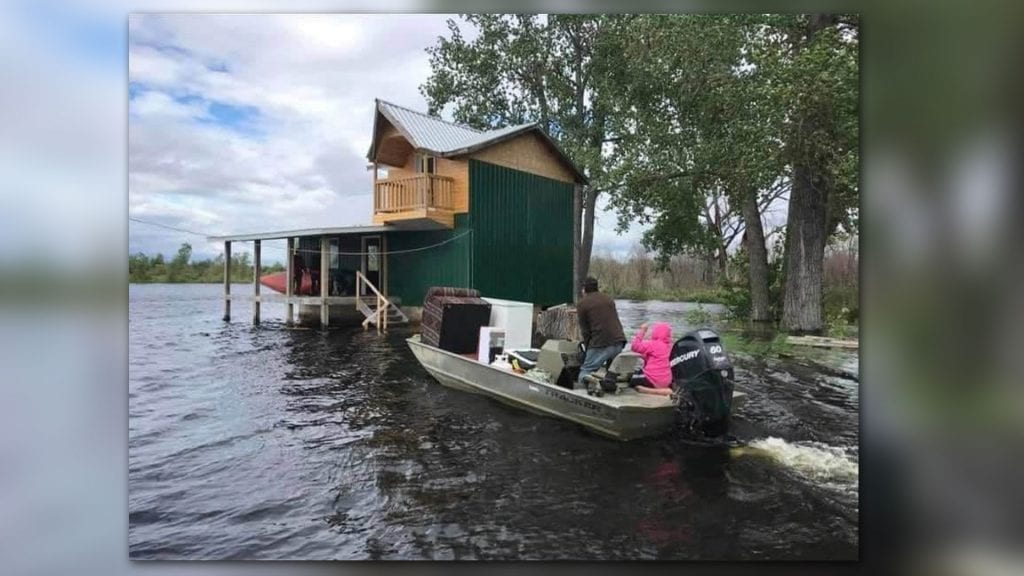
(People are dealing with flooding in the northern Saskatchewan First Nation of Cumberland House. Facebook)
Big waters are causing big problems for four, northern First Nations that straddle the Saskatchewan-Manitoba border.
Big waters is the meaning of ‘Missinipi’, the Cree name for the Churchill River, which flows east from Alberta into Saskatchewan and Manitoba.
“This is the highest I’ve seen it,” said Lynda Bird, who is keeping an eye on the Saskatchewan Island Falls hydro station from her home.
“There is lots of white water.”
The hydro station near the Manitoba border is in a state of emergency dealing with “unprecedented heavy rainfall” that is causing the Churchill to spill its banks.
WATCH THE VIDEO BELOW:
(Chelsey Pearson of Pelican Narrows, Sask., captured this drone footage above Island Falls hydro station in northern Saskatchewan on July 16.)
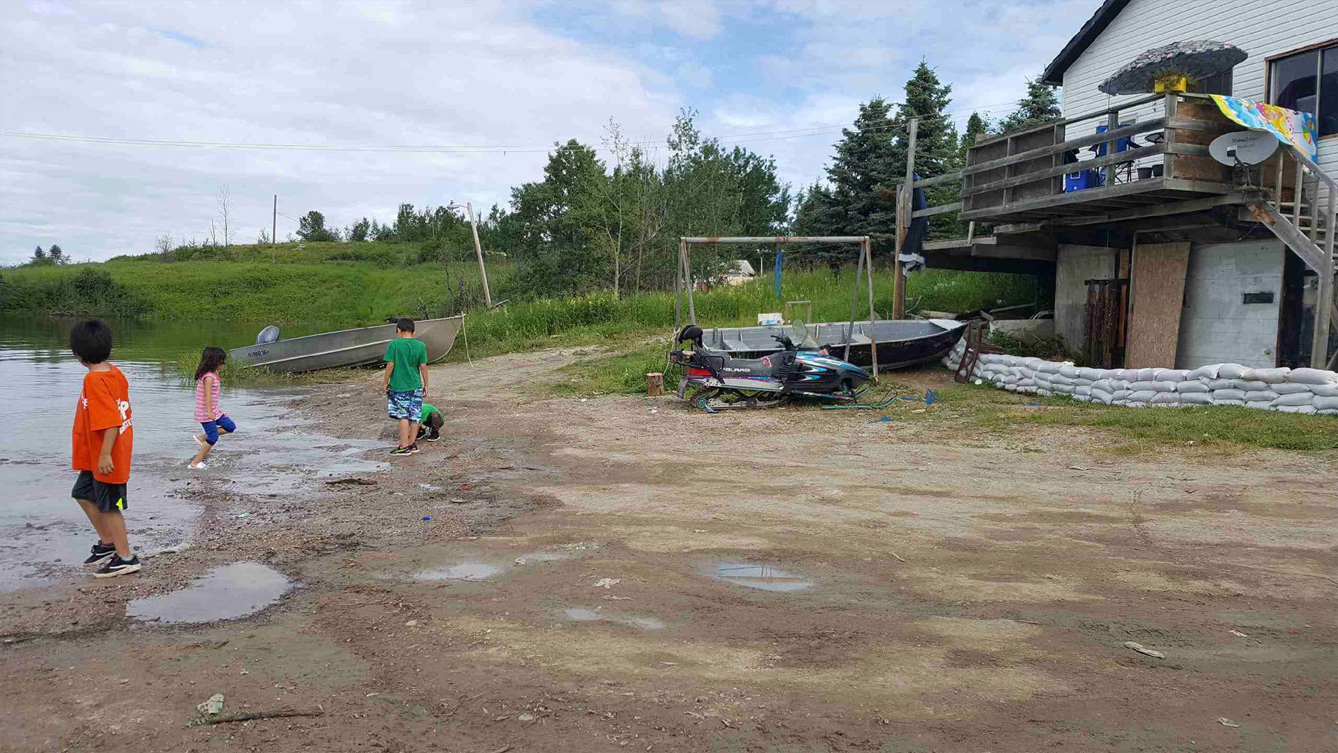
SaskPower has been releasing high water throughout the river system, which concerned residents tell APTN News is causing flooding in the Saskatchewan First Nations of Sandy Bay, South End and Cumberland House, and Manitoba’s Pukatawagan First Nation.
“Our Lands and Resources Department is currently working with Cumberland House Cree Nation which is under flood watch at this time,” said spokesperson Larissa Burnouf of the Federation of Sovereign Indigenous Nations in Saskatchewan.
“That is the only community we are aware of at this time. Lands is looking further into the matter.”
The powerful flow is also being felt in the Manitoba fly-in community of Pukatawagan, located about 800 km northwest of Winnipeg.
“Most of the people have been isolated, they can’t even go to (nearby town of The Pas) to shop for groceries,” said Sue Caribou, who has family members in Pukatawagan.
“Groceries in Puk are high prices like a small box of Minute Rice is $12.99.”
No council member was available to speak to APTN Monday.
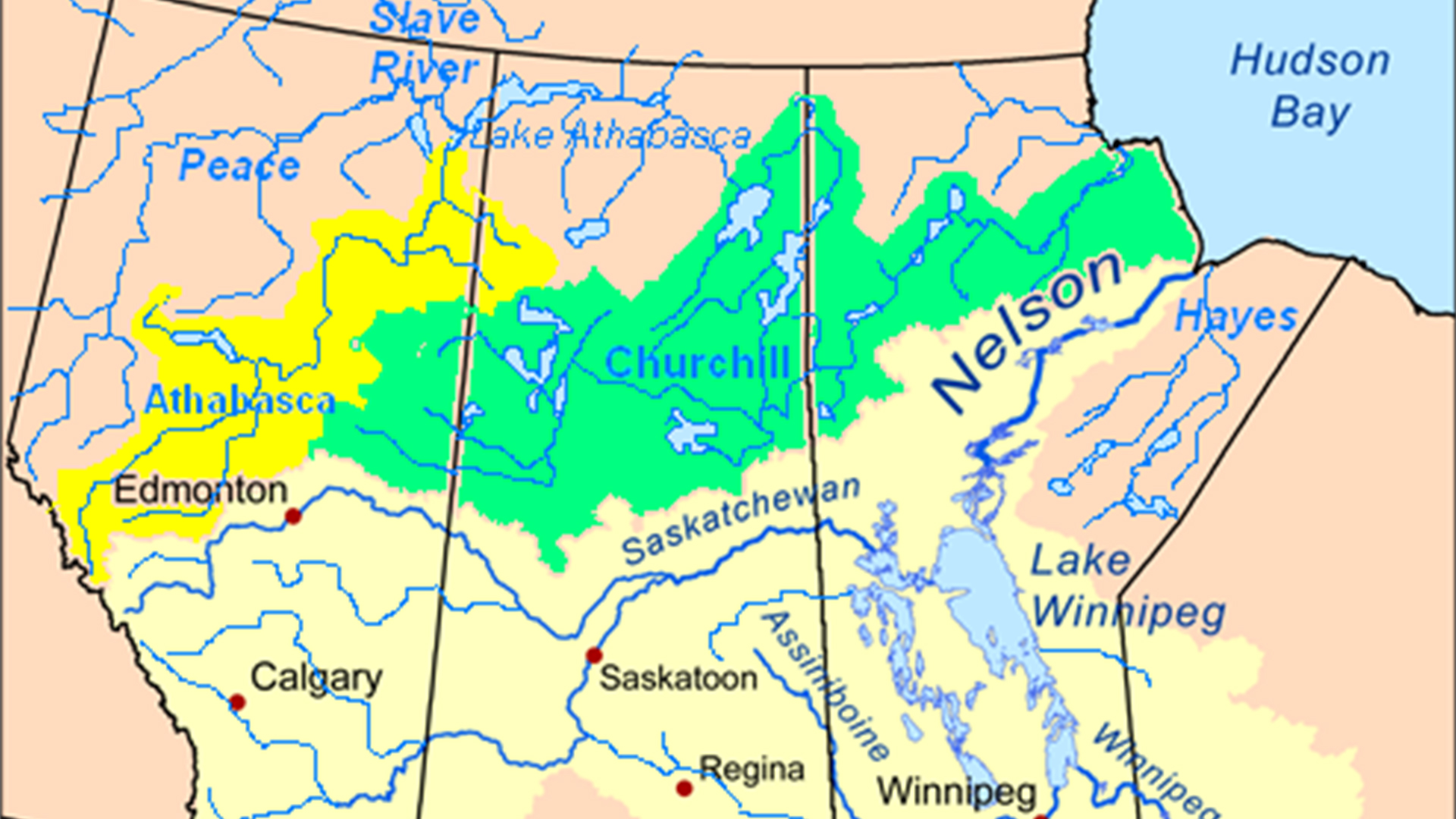
The Churchill River, which is diverted into a series of rivers and lakes before emptying into Manitoba’s Hudson Bay, was named after John Churchill, a governor of the Hudson’s Bay Company
Caribou said people in Pukatawagan are worried about how they’ll get out in an evacuation. She said only small planes fly into the community and its passenger train service isn’t operating right now.
“They are very scared to flood,” she said. “Some are already getting ready making their own sandbags.”
Back in Saskatchewan, Bird said sandbags have been stacked in front of some houses in her municipality and even inside the Island Falls hydro station in case the water breaches the aging building.
“I’m pretty worried,” she admitted in a telephone interview. “I’ve got my grandchildren here.”
Bird said she saw boats and Sea-Doos on the choppy water Sunday and wondered why there was no public safety announcement warning people to stay clear.
“There’s a lot of debris. Dead trees and branches,” she said.
She also hopes the community has its evacuation plan ready to go.
Along with eating up shoreline, Bird said the high water is swallowing the traditional medicines of sweetgrass, rapid root and rat root she picks and makes into teas for various ailments.
“I’ve got some in my medicine bag and that’s it,” she said.
SaskPower told APTN it is following the direction of the Saskatchewan Water Security Agency, where a spokesperson couldn’t be reached for comment.
Across the border, Manitoba Hydro referred questions to the Manitoba government, which did not respond before this story was published.
“We are aware of the releases from Saskatchewan but are not expecting any impacts to our facilities or operations,” Hydro’s Scott Powell said in an email.
Powell noted flooding at Thompson’s Paint Lake was not because of SaskPower or Manitoba Hydro but “well above average local precipitation.”
He said water levels in Manitoba’s third-largest city of Thompson “are about 1.5 feet above average for this time of year and about one foot lower than last year. Regular peak winter levels are 5 feet higher than the present level.”
UPDATE: This story was updated 21/07/20 to remove Thompson from the list of communities experiencing flooding after the Manitoba government said that was not the case.